


La nature est là pour qu’on en jouisse. En Aragon, il existe d’incroyables itinéraires de randonnée pour tous les publics. Plus de 3 000 kilomètres de nature, de culture et de patrimoine sont ouverts à différents types d’excursions et de niveaux, des sentiers qui permettent de connaître cette terre de contrastes, qui se reflète également dans ses chemins. Vous ne savez pas quel chemin vous convient le mieux ?
Le gouvernement d’Aragon met à votre disposition un outil pour trouver le bon à travers les Sentiers Touristiques d’Aragon. Go Aragón a sélectionné les 7 meilleurs chemins de randonnée pour leur beauté et leur polyvalence. Êtes-vous prêt à vous lancer ?
Route des passerelles d’Alquézar

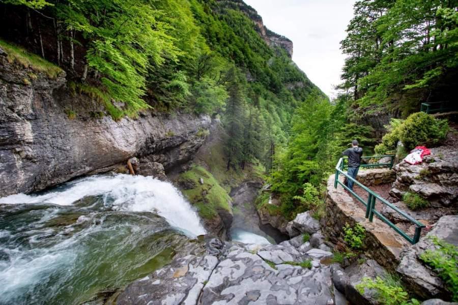
A hiking route of less than two hours, in the pre-Pyrenean area of the province of Huesca, in the heart of the Natural Park of the Sierra and Canyons of Guara. The Route of the footbridges is a perfect way to enjoy the beauty of the last stretch of the Vero River Canyon, the spectacular combination of water and rock in unique natural chaos. It is a family route. Access to the footbridges costs 4 euros and children under 11 are free.
Difficulty: Easy
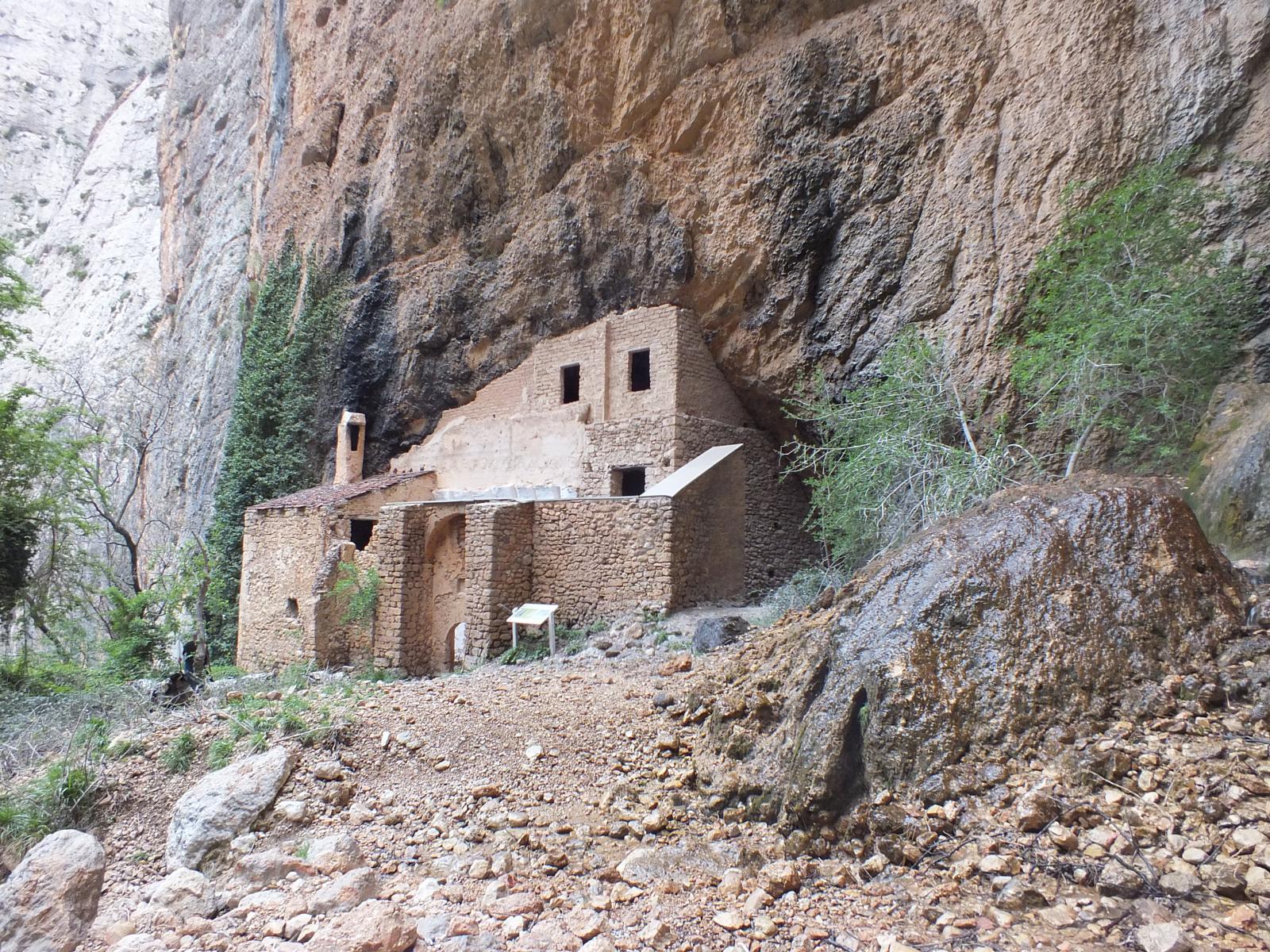
This is an incredible out-and-back route for lovers of hiking and legends. The path leads to one of the most spectacular places in the Sierra y Cañones de Guara Natural Park: the hermitage of San Martín de la Val d’Onsera. According to tradition, this hermitage, next to which there is a waterfall, was associated during the Middle Ages with fertility rituals. Aragonese kings and nobles came here in search of male offspring. This is the case of the king of Aragon, Pedro IV, who travelled to the hermitage to ask his third wife, Doña Leonor, to have a son. And he succeeded. The walk passes between stretches of high conglomerate walls that form a twisted canyon, and several kilometres of path, called the Path of the Donkeys.
Difficulty: Moderate
Ordesa and the Cola de Caballo (Horse’s Tail)
Almost eight hours of round-trip walking in the Ordesa y Monte Perdido National Park. It has become one of the most popular routes in the Pyrenees, with a landscape dominated by cliffs, waterfalls, forests and meadows. The views of Marboré, Monte Perdido and Añisclo are truly marvellous. Not to mention the Gradas de Soaso… The obligatory photo at the waterfalls is a must! In the Ordesa y Monte Perdido National Park there are many other routes not to be missed.
Difficulty: Easy

Starting from Calmarza, on the banks of the river Mesa, this circular route takes you through one of the most beautiful areas of the province of Zaragoza. One of the first surprises of the route is the discovery, partially embedded in the rock, of the Sanctuary of the Virgin of Jaraba. The hiking route is punctuated by sheepfolds, corrals and other shepherding constructions, and sheltered by the enormous rock walls of the ravine. Enjoy its beautiful unsuspected corners and its magnificent fauna. In 2009 a resident of Jaraba discovered cave paintings more than 7,000 years old.
Difficulty: Easy

The Moncayo serves as a border between Zaragoza and Soria and climbing to its summit is a hike for almost everyone. It is not a tourist trail, but despite being a fairly easy climb. In almost five hours you can reach the summit and descend, and you will have reached an altitude of 2,314 metres. Not bad, is it?
Difficulty: moderate
Path to the source of the Pitarque River

A flat out-and-back route along a path that goes from Pitarque to the source of the river of the same name. The path goes through abandoned orchards until it reaches the hermitage of the Virgen de la Peña. Afterwards, a spectacular canyon of high walls rises up, modelling the course of the river. The vegetation and the presence of birds of prey are outstanding. The old hydroelectric power station with its watchtowers gives a historical and heritage touch to the walk, until you reach the outcrop of the first waters that flow on the surface.
Difficulty: Easy
Guadalaviar River Nature Trail

Although it is not considered a tourist trail in Aragón, its high tourist interest makes us include this trail in our selection. Framed in the Sierra de Albarracín, this quiet river trail that runs from Sn Blas to the old Arquillo dam is a magnificent walk to enjoy with the family. A 7-kilometre route with suspension bridges and footbridges.
Difficulty: easy
Do you want to know more nature routes? In Aragon we have 3 of the most striking routes with footbridges in Spain.


